|
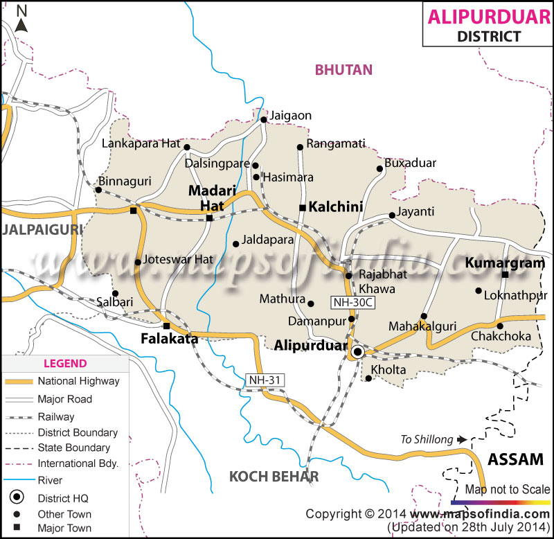
Alipurduar district district has been carved out from Jalpaiguri on 25th June,
2014 as the 20th district in the state of West Bengal, India. It consists of Alipurduar
municipality and six community development blocks viz Madarihat–Birpara, Alipurduar–I,
Alipurduar–II, Falakata, Kalchini and Kumargram.
There are 66 gram panchayats and nine census towns in six blocks.
The district has its headquarters at Alipurduar. It comprises mainly
of a rural population. More than 80 per cent of its total population
belong to SC/ST community. It is the hometown of various ethnic tribes
like Rajbanshi, Rabha, Metch, Santhals, Madasia, Bodo and Toto & Oraons
which makes the place more labyrinths.

Geographically Alipurduar is a land locked district bordered by Jalpaiguri in the west,
Assam in the east and Coochbihar in the south. In the north the district shares an
international border line with Bhutan. The topography of the land is cut across by rivers,
streams and hills, and covered with tea gardens and forests. Major rivers that runs across
the district are the Torsa, Raidak, Kaljani, Sankosh and Gadadhar.
Census Data
| Description |
2011 |
| Actual Population |
15,01,983 |
| Male |
7,70,905 |
| Female |
7,31,078 |
| Area Sq. Km |
3136 |
| Population Density/km2 |
539 |
| Sex Ratio (Per 1000) |
948 |
Divisions
Administrative subdivisions
The district comprises only one sub-divisions: Alipurduar. Alipurduar consists of Alipuduar
& Falakata municipality and six community development blocks: Madarihat, Falakata, Kalchini,
Alipurduar-I, Alipurduar-II, Kumargram with 6 nos. of Panchayet Samiti and 66 nos. of Gram Pnachyet,
there are 8 police stations and 3 Police outpost in this district.
Alipurduar subdivision
- Alipurduar: Municipality
- Madarihat-Birpara (Community development block) consists of rural areas only with 10 Gram Panchayats.
- Alipurduar I (Community development block) consists of rural areas with 11 Gram Panchayats and four census towns:
Paschim Jitpur, Chechakhata, Alipurduar Railway Junction and Bholar Dabri.
- Alipurduar II (Community development block) consists of rural areas with 11 Gram Panchayats and one census town: Sobhaganj.
- Falakata (Community development block) consists of rural areas with 12 Gram Panchayats and one census town: Falakata.
- Kalchini (Community development block) consists of rural areas with 11 Gram Panchayats and two census towns: Jaygaon and Uttar Latabari.
- Kumargram (Community development block) consists of rural areas with 11 Gram Panchayats and one census town: Uttar Kamakhyaguri.
|